
Climate Table Black Forest
Jan | Feb | Mar | Apr | May | Jun | Jul | Aug | Sep | Oct | Nov | Dec | |
|---|---|---|---|---|---|---|---|---|---|---|---|---|
| Max. Temperature | 5° | 7° | 11° | 15° | 20° | 23° | 25° | 25° | 21° | 15° | 9° | 6° |
| Min. Temperature | 0° | 1° | 4° | 6° | 10° | 13° | 16° | 15° | 12° | 8° | 3° | 1° |
| Sun Hours | 2 | 3 | 4 | 5 | 6 | 7 | 7 | 6 | 5 | 4 | 2 | 2 |
| Rain Days | 11 | 10 | 11 | 12 | 12 | 12 | 11 | 10 | 9 | 11 | 11 | 11 |
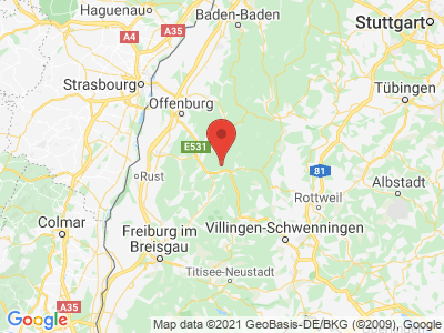
Map view of Black Forest
The climate year of Black Forest
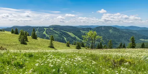
Until about 10,000 years ago, the Black Forest was covered with glaciers, of which some lakes such as Mummelsee, Wildsee, Schurmsee and Titisee are still remnants of this ice age. Climatically, it stands out from the surrounding landscape by having lower temperatures and higher precipitation. The climate of the Black Forest itself varies greatly, and is characterized by the fact that temperatures do not decrease and precipitation increases as altitude increases; instead, precipitation increases at lower elevations, especially on the western side of the Black Forest. However, most of the rain falls in the northern Black Forest with about 2200 mm per m² per year. Winter is relatively mild and snowy, and there have been years with 100 snow days in the higher elevations. Just so, inversion weather conditions in winter can lead to sunshine on the peaks, while it is cold and foggy for days in the valley.
General information about Black Forest
Feldberg is one of the most famous mountains in the Black Forest. There is a cable car leading to the Seebuck foothill, which is operated as a chairlift in winter. After a 2 km walk you reach the Feldberg summit. In the summit area of the Feldberg you will find several circular hiking trails with magnificent views of the landscape, and those who climb the Feldberg tower will see even further into the distance. The Wutach Gorge is a nature reserve and offers many parking places for hikers and a hiking bus that brings the hiker back to his car. The water masses of the melting glaciers at the Feldberg have created the Wutach Gorge. On the Black Forest High Road lies Lake Mummel at 1032 meters above sea level, behind which rises the Hornisgrinde at 1164 meters. It is the highest elevation in the Black Forest and also offers a magnificent view. The Belchen is the most beautiful mountain of the Black Forest. The summit can no longer be reached by car, but the Belchenbahn brings the visitor comfortably to the top, of course, it is also easy to do by bike or on foot.
Tourism Black Forest
Hornisgrinde, Feldberg and Belchen are the areas of the Black Forest with the highest precipitation, in the east of the central Black Forest precipitation is not so high. In a temperature comparison, the difference between the Ortenau with its wine-growing areas and the Hornisgrinde over a distance of 10 km is as different as southern Scandinavia to northern Italy. The frequent high-pressure weather in winter provides sunshine on the summits of the Black Forest mountains, while dense fog prevails in the valleys. The measured maximum temperatures range from 20°C to 25°C from June to September and the lowest average temperatures are around 0°C from November with 3°C to January/February. The rainy days are distributed more or less evenly throughout the year and the sunshine hours are highest in June and July with 7 hours per day.