
Climate Table Cairo
Jan | Feb | Mar | Apr | May | Jun | Jul | Aug | Sep | Oct | Nov | Dec | |
|---|---|---|---|---|---|---|---|---|---|---|---|---|
| Max. Temperature | 19° | 21° | 23° | 28° | 32° | 24° | 34° | 34° | 33° | 30° | 25° | 20° |
| Min. Temperature | 9° | 10° | 12° | 15° | 18° | 20° | 22° | 22° | 20° | 18° | 14° | 10° |
| Sun Hours | 7 | 8 | 9 | 9 | 10 | 12 | 11 | 11 | 9 | 9 | 8 | 6 |
| Water Temperature | 15° | 15° | 18° | 21° | 24° | 26° | 27° | 27° | 28° | 24° | 21° | 17° |
| Rain Days | 1 | 1 | 1 | 1 | 1 | 1 | 0 | 0 | 0 | 1 | 1 | 1 |
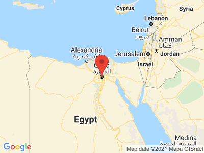
Map view of Cairo
The climate year of Cairo
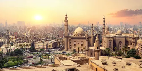
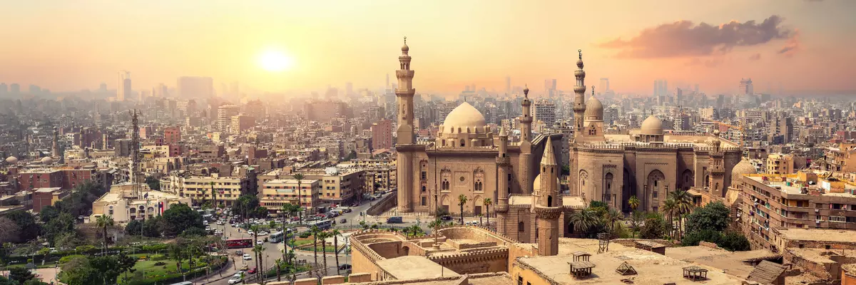
Cairo, the capital of Egypt, is located in the northeast of the North African country on the western bank of the Nile River. The urban area covers an area of 214 square kilometers. The two islands of Gezira and Roda are also part of Cairo. The old city center of Cairo is bounded by the Muqattam mountain spur to the east and the Nile to the west. On the left bank of the Nile is the governorate of al-Jiza, where the pyramids of Giza and the Sphinx are located, among others. To the north of the city begins the Nile Delta. To the south of Cairo is the ancient pharaonic city of Memphis. Cairo is located in the subtropical climate zone. The region has a warm and dry desert climate. Especially in the summer months it is extremely hot in Cairo. Sandstorms from the south of the country are also frequent at this time of year.
General information about Cairo
With over 120,000 art treasures covering history from the earliest dynasties to the Roman era, the Egyptian Museum is one of the top choices for visitors to Cairo. From the impressive collection, the exhibits related to the pharaoh Tutankhamun stand out in particular. In addition to the famous death mask, there are thousands of other treasures from the tomb of the young pharaoh to marvel at. About 15 kilometers from Cairo are the pyramids of Giza, probably the most famous buildings of mankind. The pyramids are the last of the six wonders of the ancient world. In the immediate vicinity is the Great Sphinx of Giza. Also worthwhile is a visit to the inhabited cemeteries of Cairo, the so-called "cities of the dead". Like once the Egyptian pharaohs, the well-heeled inhabitants of Cairo build magnificent mausoleums for their deceased.
Tourism Cairo
The Egyptian capital Cairo is located in the subtropical climate zone. It has a warm and dry desert climate all year round. Therefore, those who are flirting with a trip to Cairo should carefully consider at what time of year they will visit the city of over a million inhabitants.
January is the coolest month in Cairo. "Cool" means in this context, however, that the temperatures are usually still in double digits and rather comparable to the German spring temperatures. Also the months of February and March are still pleasantly mild, which makes a sightseeing tour relaxed. From April on, the thermometer in Cairo shows high summer temperatures, which, however, are still quite bearable for Central Europeans. This trend continues in May and June. However, during these months, sandstorms from the south may hit the city. July and August are the hottest months in Cairo. A visit is not recommended during this time. Only from September there are signs of a slight cooling. In October, November and December, temperatures return to a bearable level.
Precipitation and rainy days are negligible for Cairo. In the months of June to September, a few raindrops can fall here and there, but not so that it could spoil the stay. In December 2013, it snowed in Cairo for the first time in over a hundred years.