
Climate Table La Gomera
Jan | Feb | Mar | Apr | May | Jun | Jul | Aug | Sep | Oct | Nov | Dec | |
|---|---|---|---|---|---|---|---|---|---|---|---|---|
| Max. Temperature | 21° | 21° | 22° | 23° | 24° | 25° | 27° | 29° | 28° | 26° | 24° | 22° |
| Min. Temperature | 15° | 15° | 15° | 16° | 17° | 18° | 20° | 21° | 20° | 19° | 18° | 16° |
| Sun Hours | 6 | 6 | 7 | 8 | 9 | 9 | 9 | 9 | 8 | 7 | 6 | 5 |
| Water Temperature | 19° | 18° | 18° | 18° | 19° | 20° | 21° | 22° | 23° | 23° | 21° | 20° |
| Rain Days | 6 | 4 | 3 | 2 | 2 | 1 | 0 | 0 | 2 | 5 | 6 | 7 |
Map view of La Gomera
The climate year of La Gomera
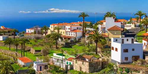
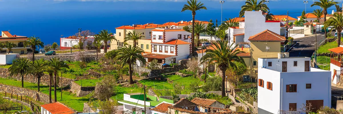
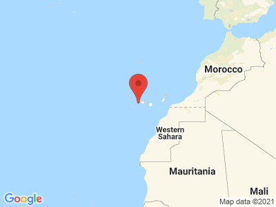
La Gomera is located 55 kilometers southeast of La Palma, about 30 kilometers west of Tenerife and just under 60 kilometers from El Hierro. The 12 million year old volcanic island is circular and quite manageable with a surface area of 378 square kilometers. Only 22,259 inhabitants live on the small island. Although the coast is 98 km long, there are only 15 km of beaches. Of these, however, only 0.5 km are sandy beaches. Most of the beaches consist of coarse gravel. Therefore, the island is less suitable for a bathing or beach vacation. The trademark of the Spanish nature island is its impressive primeval forest with erica and laurel trees and the world famous whistling language "El Silbo". In contrast to the larger neighboring Canary Islands, tourism on La Gomera is not yet very developed. La Gomera can be approached via Tenerife (flight time about 5 hours). Alternatively, it is possible to get to the island by ferry from Cadiz in Spain, but this takes 36 hours.
General information about La Gomera
The climate of the island is determined by an Azores high and the Canary Current, a part of the Gulf Stream. Therefore, there are hardly any significant temperature fluctuations. Days with etremer heat are rare and come usually only, if air currents carry sand from the Sahara on the island (Calima). Trade winds provide the small Canary Island with a lot of moisture through drip and drizzle. During this time, the wonderful Garajonay National Park resembles a mystical enchanted forest. In the higher altitudes, it can therefore quickly become cool even in summer. However, even in winter, temperatures are always in the double digits. Due to the Gulf Stream, temperatures remain around 20 degrees all year round. In the months of January and February the high pressure zone declines. This results in heavy rainfall down to the lowlands. Nevertheless, temperatures here are always spring-like compared to Central European conditions. Therefore La Gomera is also called the island of spring. Due to its optimal geomorphological position, the island is considered to have particularly favorable weather. Gomera does not know weather fluctuations as on the neighboring islands. In addition, the small Canary Island is located in the lee of the big brother Tenerife, which further favors the temperate climate.
Tourism La Gomera
Although La Gomera is not very big, there is a lot of nature to admire and some interesting things to discover. The most famous sight is the Garajonay National Park. In 1986, UNESCO included the Canary forest area with the unique " Bosque del Cedro" and the diverse laurel forest in the list of cultural assets worthy of protection. An insider tip for hikers and nature lovers is the area around Playa Santiago, which can be easily mastered even by beginners. The towns of Hermiqua and Valle Gran Rey are also popular with hikers. A very special experience are the world famous organ pipes "Los Organos". This natural wonder is located about 200 meters along the impressive cliff of Punta de las Salinas. The basalt tubes created by nature extend almost 80 meters high and look like organ pipes rising from the sea.